| Where | East-central Sardinia, spanning Oliena, Orgosolo, Urzulei, Dorgali, and Baunei |
| Known for | Gorropu canyon, the hidden village of Tiscali, and cliffs above the Gulf of Orosei |
| Time needed | A single day hike is possible, but 2-4 days gets the most from the area |
| Cost | Guided canyon and Tiscali hikes typically €50-100; boat trips to Cala Luna from around €25-40 |
| Best time | April-June and September-October; the limestone offers little shade and gets punishing by midday in summer |
A mountain wilderness with almost no roads
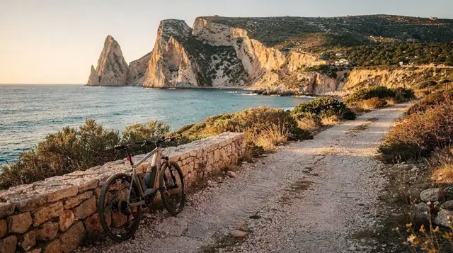
The Supramonte isn’t a single peak or town — it’s a limestone massif roughly 35km across, straddling the territory of five interior and coastal municipalities: Oliena and Orgosolo on the western side, Urzulei and Baunei to the south, and Dorgali reaching towards the coast at Cala Gonone. What unites it is terrain: karst limestone riddled with gorges, sinkholes, and cave systems, largely uninhabited, with much of the interior accessible only on foot or by 4x4 track.
That isolation is precisely why the Supramonte still holds populations of mouflon (wild mountain sheep) and golden eagles that have been pushed out of more accessible parts of the island, and why sites like Tiscali survived essentially unknown to outsiders until the 1880s. It’s also why the Supramonte demands more from visitors than most of Sardinia’s attractions — this isn’t a drive-up viewpoint circuit, it’s a hiking destination in the fullest sense.
Gorropu: one of Europe’s deepest canyons
The signature feature is Gorropu, a limestone gorge with walls rising up to around 400-500 metres in places, cut by the Flumineddu river over millennia. Depending on the route, you can approach from above via a demanding descent, or via the gentler, more popular route along the canyon floor from the Genna Silana pass side. A Gorropu Canyon trek with off-road transfer and lunch from Dorgali covers the approach by 4x4 before the walking section, cutting out a long drive on rough track.
For a version with a stronger focus on the panoramic approach, a trek to Gorropu with panoramic views, also from Dorgali, takes around 8 hours and includes some of the best overlook points before descending. From the Urzulei side, an Urzulei-based guided hiking tour of the Gorropu canyon offers a genuinely different approach angle worth comparing if you’re deciding where to base yourself. Our dedicated Gola su Gorropu hike guide breaks down the route options and difficulty levels in more depth.
Tiscali: the village hidden inside a mountain
Tiscali is the Supramonte’s other headline site — a nuragic-era settlement built inside a collapsed doline (sinkhole), completely invisible from outside until you’re standing at its rim. It’s most commonly accessed from Oliena, but routes also run from the Orosei side.
A guided hike to Tiscali mount from the Orosei/Dorgali area covers roughly 8 hours including transfers, while an Orosei-based Tiscali Mountain and nuragic village hike offers a comparable route from a different starting point. Whichever approach you choose, the trail involves genuine elevation gain over rocky, sometimes exposed terrain, and a guide materially improves both safety and the amount you’ll understand about what you’re seeing once you reach the site. See our Tiscali nuragic village hike guide for a fuller route comparison.
The coast where the mountains meet the sea
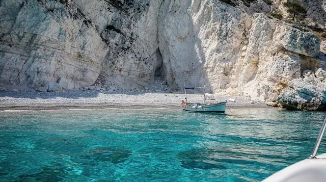
The Supramonte’s eastern edge doesn’t taper gently into the coast — it drops as sheer limestone cliffs straight into the Tyrrhenian Sea along the Gulf of Orosei, creating a stretch of coastline reachable almost entirely by boat or on foot via the demanding Selvaggio Blu trek.
Cala Luna, one of the gulf’s best-known beaches, backs directly onto Supramonte caves and cliffs, and a boat trip from Cala Gonone to Cala Luna is the standard, straightforward way to reach it without the multi-day trek.
For exploring the water itself rather than just the beach, a snorkelling trip in the Orosei Gulf covers sea caves and clear water along this same stretch of cliff. Our Gulf of Orosei boat trips guide compares the various departure points and boat formats, and the Selvaggio Blu trek guide covers the multi-day coastal hiking option for anyone wanting to see this coastline entirely on foot.
Wine after the trail
Dorgali, on the Supramonte’s north-eastern edge, sits within the Cannonau di Sardegna Classico subzone, one of the grape’s most respected growing areas, and makes a natural stop for a tasting after a day on the trails. A Dorgali winery tour with tasting and a local guide covers a working cellar and a sit-down tasting, a good way to end a demanding hiking day without much extra driving. Our Cannonau wine guide has more on how Dorgali’s style compares to Oliena’s or the island’s coastal producers.
Planning a Supramonte trip
Because the massif spans several access towns, where you base yourself changes what’s practical day to day. Oliena suits Tiscali-focused trips; Dorgali and Cala Gonone suit Gorropu and the coastal boat trips; Orgosolo and Nuoro work well if you’re combining hiking with Barbagia culture. Multi-day visitors often split time between an interior base and a coastal one to cover both sides properly — our Sardinia hiking itinerary sketches out a full week built around exactly this kind of split.
Getting around
There’s no meaningful public transport network within the Supramonte itself — trailheads are reached by hire car, and the interior tracks beyond the trailheads are on foot or by guided 4x4 only. Roads into the access points are narrow, winding, and considerably slower than a straight-line distance suggests, in keeping with the roughly 60 km/h average speed typical of Sardinia’s non-motorway network described in our driving in Sardinia guide. Mobile signal is patchy to non-existent on many of the trails, which is another reason a guide is worth the cost for first-time visitors.
Practicalities: fees, water, and what to bring
Independent access to Gorropu isn’t free even without a guide — a modest per-person entrance toll applies at the barrier on the approach track, payable in cash, since card machines are unreliable this deep into the interior. Bring more water than feels necessary; there’s no reliable refill point once past the trailheads, and the pale limestone reflects heat back at you on top of whatever the air temperature reads. A hat, proper walking shoes with real grip — not sandals or worn-out trainers — and a downloaded offline map are all worth having, since mobile signal drops out across much of the massif.
Sardinia’s mountain rescue and general emergency services can be reached on 112, and it’s worth telling someone your planned route and return time before setting out on any of the longer trails, given how patchy coverage is. None of the main trailheads have facilities beyond basic parking, so plan fuel and food stops in Dorgali, Oliena or Baunei before heading in.
Frequently asked questions about the Supramonte
Is the Supramonte suitable for casual walkers?
Not really. Most of its signature hikes — Gorropu, Tiscali — involve several hours of walking on uneven, exposed limestone terrain with real elevation gain. It rewards fitness and preparation more than most of Sardinia’s attractions.
Do I need a guide for Gorropu or Tiscali?
It’s strongly recommended for both. Trails are inconsistently marked, mobile signal is unreliable, and guides add substantial historical and geological context that’s easy to miss on a solo hike.
What’s the best base for exploring the Supramonte?
It depends on your priorities: Oliena for Tiscali, Dorgali or Cala Gonone for Gorropu and the coastal boat trips, Orgosolo or Nuoro if you want to combine hiking with Barbagia culture.
Can you reach the Supramonte’s coastline without hiking the Selvaggio Blu?
Yes — boat trips from Cala Gonone reach beaches like Cala Luna directly, without requiring the multi-day trek, which remains an option only for well-prepared, experienced hikers.
Is there an entrance fee for Gorropu?
Yes — a modest per-person toll applies at the barrier on the approach track even for independent hikers without a guide, payable in cash.
What wildlife might I actually see?
Mouflon are the most realistic sighting, especially early morning or evening near the canyon rims; golden eagles do appear but far less predictably. Keep a respectful distance from either and never feed them.