Why the map lies about driving times in Sardinia
Type “Cagliari to Cala Gonone” into a mapping app and it will tell you roughly two hours. Drive it and it takes closer to two and a half, and that is on a good day with no tractor, no flock of sheep crossing, and no stop at a service station that turns out to be shut. Sardinia is one of the worst places in Europe for trusting a straight-line time estimate, and it catches out first-time visitors on almost every itinerary that tries to cover the island properly. Our driving in Sardinia guide covers the practical rules of the road; this one is specifically about why the numbers on your screen are wrong.
There is basically one motorway on the whole island
The SS131 “Carlo Felice” running from Cagliari up to Sassari is the only stretch of road on Sardinia that behaves like a mainland motorway — dual carriageway, no roundabouts, a realistic 110 km/h. Everything else, including roads marked as major on a map, narrows to a single lane each way within a few kilometres of any town, and a meaningful share of the secondary network is unmarked, unlit, and shared with agricultural traffic. Once you leave the SS131 corridor, the average cruising speed most drivers actually achieve drops to around 60 km/h, not because of traffic but because the roads themselves do not allow more.
Coastal roads are the worst offenders
The roads that hug the coast — the ones that pass the beaches you actually want to see — are consistently the slowest on the island. The route along the Golfo di Orosei toward Baunei climbs and drops through switchbacks cut into limestone cliffs, and a 40 km stretch that a map suggests takes 40 minutes can genuinely take an hour and a half if you stop for photos, which you will, repeatedly.
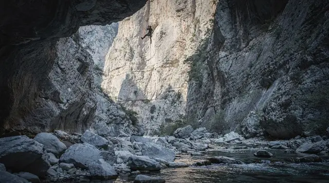
The interior roads through the Supramonte toward trailheads for hikes like Gola su Gorropu or the start of the Selvaggio Blu trek are narrower still, often a single lane with passing places, and a satnav has no way of knowing that.
Why the algorithm gets it wrong
Most mapping software calculates time from a road’s classification and posted speed limit, not from how the road actually behaves. A secondary road marked with a 90 km/h limit gets treated as a 90 km/h road in the calculation, even when the real-world corner radius, surface quality and gradient make anything past 50 km/h genuinely unsafe. Add in the fact that Sardinia’s road signage is inconsistent between provinces, and it is easy to miss a turn and add another 15 minutes without the app updating in time to warn you. Assume roughly 25-40% longer than whatever your phone says for any route that leaves the SS131.
What this means for planning your route
The practical fix is to plan by regions, not by point-to-point hops across the island. Our 7-day itinerary and the region-specific north and south versions are built around this — basing in one area for several nights and doing day trips from there, rather than changing hotels every night and covering long cross-island distances repeatedly. If your itinerary has you driving more than about two hours in a single day, budget the whole morning or afternoon for it rather than treating it as a quick transfer between activities.
A guided day out is a genuinely useful way to cover a demanding stretch of road without doing the driving yourself, particularly around the more technical inland tracks south of Cagliari:
Cagliari 4x4 tour to Villasimius and its beachesThe Barbagia interior is another area where a driver who knows the roads is worth the cost, especially if you want to reach a working sheep farm for lunch without white-knuckling unmarked forestry tracks:
Barbagia jeep tour and shepherd’s lunch from ArbataxReal routes, map time versus actual time
These are genuine, commonly driven routes, compared against what mapping apps typically quote and what the drive actually takes once stops, terrain and rural traffic are accounted for.
| Route | Map estimate | Realistic time |
|---|---|---|
| Cagliari to Cala Gonone | ~2h05 | 2h30-2h45 |
| Alghero to Santa Teresa Gallura | ~2h10 | 2h45-3h |
| Olbia to Alghero | ~2h20 | 2h45-3h15 |
| Dorgali to Baunei (coast road) | ~40min | 1h-1h30 |
| Cagliari to Barumini | ~55min | 1h05-1h20 |
The pattern is consistent: the gap grows the further a route strays from the SS131, and it grows fastest on coastal or mountain roads even when the straight-line distance looks modest.
Fuel stops and rural services on a Sunday
A detail that catches out visitors more than the driving speed itself: many rural petrol stations, particularly in the interior around the Gennargentu and smaller towns off the main routes, close on Sunday afternoons and sometimes all day, and card-only self-service pumps are not universal outside the bigger towns. Fill up before a Sunday drive into the interior rather than assuming a station will be open when the tank runs low, and keep in mind that fuel prices at small rural stations can run 10-15% higher than at a supermarket-attached station in a larger town like Cagliari or Sassari.
Airports and why your arrival point matters
Which of the three airports you fly into changes your whole route, since driving across the island to reach your first stop can eat a full day. Our guides to Cagliari-Elmas, Olbia Costa Smeralda and Alghero-Fertilia each cover which regions each airport genuinely suits — landing in Olbia and trying to reach Alghero the same evening, for instance, is a three-hour drive most visitors underestimate badly.
Rural hazards that slow things down further
Free-ranging sheep, cattle and the occasional pig crossing the road are a routine hazard on interior and even some coastal roads, and local drivers slow for them without complaint because everyone understands the alternative. Farm machinery moving between fields during the September harvest, covered in our wine harvest guide, adds further unpredictable delays on the roads around Dorgali specifically. None of this is dangerous if you drive at a sensible speed for the road, but it does mean the “confident” time estimate on a map is rarely the one you should plan around.
For the full breakdown of what a hire car actually costs once insurance and fuel are added in, our Sardinia car hire traps guide and real cost of a week guide go through the numbers.
Frequently asked questions about driving times in Sardinia
Is there a motorway across Sardinia?
Only the SS131 between Cagliari and Sassari behaves like a true motorway; every other major road narrows to a single lane in each direction outside towns.
How much longer should I plan than my map app suggests?
Add at least 25% for any route off the SS131, and closer to 40-50% for coastal roads around the Golfo di Orosei or tracks into the interior.
Is it faster to fly between regions of Sardinia instead of driving?
There are no scheduled internal flights on the island — driving, or occasionally the coastal Trenino Verde scenic train, are the only options.
Why do coastal roads take so much longer than inland ones of the same distance?
Coastal roads, particularly around the Golfo di Orosei, are cut into cliffs with continuous switchbacks, which limits safe speed regardless of the posted limit.
Should I hire a smaller car to make narrow roads easier?
A compact car helps on the narrowest village streets, but comfort and visibility over several hours of driving matter more than size on most of the island’s roads.
Are rural petrol stations open on Sundays?
Not always — many close on Sunday afternoons in smaller towns, so fill up in advance rather than relying on finding an open station in the interior.
Does it matter which order I visit regions in?
Yes — routing to minimise long cross-island transfers, rather than following a straight line around the coast, saves real driving hours over a week-long trip.
Transport passes & transfers on GetYourGuide
Verified deep-linked GetYourGuide tours. Book through these links and we earn a small commission at no cost to you.
These are our own photographs of Sardinia, not the operator's pictures of this tour — open the tour page to see those.